《TAIPEI TIMES》 Mekkhala likely to near Taiwan on Thursday: CWA
我們所做的一切,都是為了讓下一代不必再做我們所做的事。
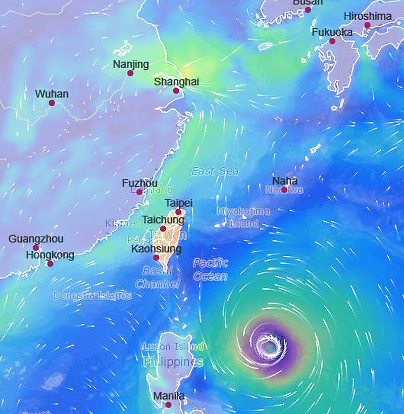
A weather graphic depicts Typhoon Mekkhala southeast of Taiwan yesterday. Photo courtesy of the Central Weather Administration
/ Staff writer, with CNA Typhoon Mekkhala is likely to come closest to Taiwan on Thursday, according to the Central Weather Administration (CWA), which forecast localized rain or thundershowers in western and northeastern parts of the country for that day.
As of 2pm yesterday, the eye of the storm was 770km southeast of Oluanpi (鵝鑾鼻), the southernmost point of Taiwan, as it continued to move toward waters east of the Philippines, the agency said.
Mekkhala was expected to become a severe typhoon last night, CWA forecaster Lai Hsin-kuo (賴欣國) said.
A severe typhoon has maximum wind speeds of more than 184kph, compared with 118kph to 183kph for a moderate typhoon, according to the agency.
After Mekkhala comes closest to Taiwan on Thursday, it is expected to move northeasterly toward Japan and weaken, Lai said.
As the typhoon’s center would be about 400km to 500km from Taiwan at its closest approach, the CWA is not likely to issue a sea warning, he said.
However, under the shadow of the outer band, Taiwan is expected to see brief showers or thundershowers in western and northeastern areas, while cloudy skies are expected for the rest of the main island, he said.
Mekkhala is expected to move away from Taiwan starting on Friday, and with a weather front weakening on Sunday and Monday, typical hot summer weather would return, Lai said.
Today, highs are expected to reach 32°C to 34°C around Taiwan, with 37°C possible in the Taipei area, mountainous areas in central and southern Taiwan, and parts of Hualien and Taitung counties, he said.
From Thursday to Sunday, daytime highs are expected to fall to 31°C to 33°C, Lai said.
新聞來源:TAIPEI TIMES